Geocoding
Geocoding is the process of converting addresses into geographic coordinates (latitude and longitude). Reverse geocoding is the process of converting geographic coordinates into an address
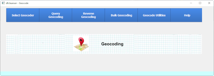
The Geocoding Utility provides the following functionality.
- Geocoding
- Reverse Geocoding
- Distance Calculation
- Center Point Calculation
- Distance From Center Point Calculation
The Geocoding Utility runs in the following modes.
- Interactive
- Bulk
- Utilities
Geocoding uses a subset of the geocoding services supported in .
Geocoding uses commercial geocoding services to provide the correct interface for getting data.
The user must get an API key from the desired service to use in the geocode connector.
The user is responsible for obtaining all api key requirements of each service you want to use.
Get API requirements from links below.
The supported geocoding services are :
Select Geocoder
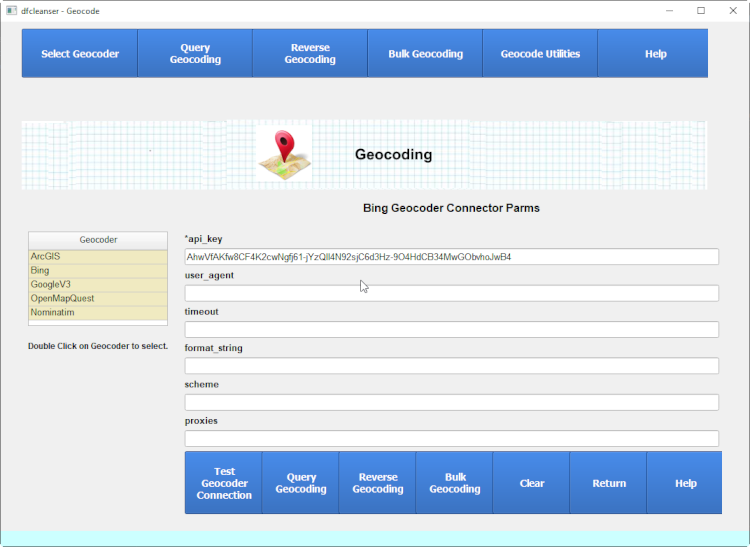
It is recommended to fill in the correct geocoder connect parms and test the geocoder connection before doing geocoding.
Connection Test

Interactive Geocoding
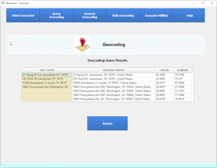
Interactive Geocoding allows the user to manually retrieve coordinates for an address or group of addresses.
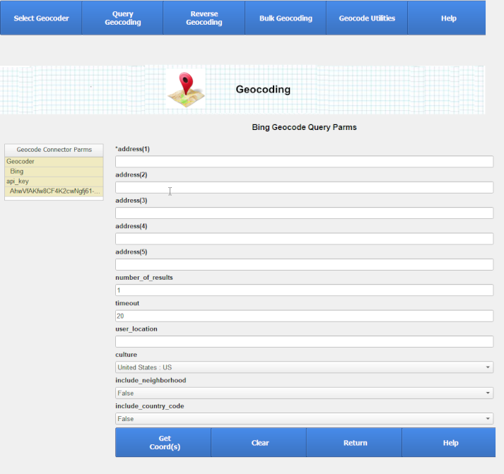
Interactive Geocoding Results
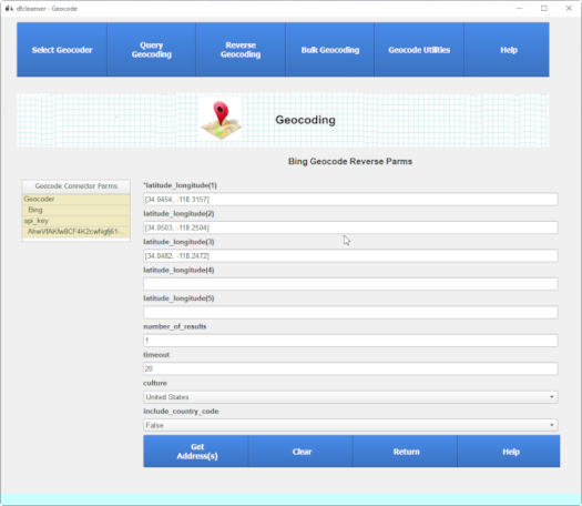
Interactive Reverse Geocoding
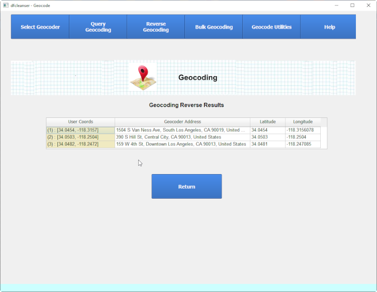
Interactive Reverse Geocoding Results
Bulk Geocoding
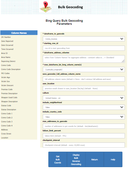
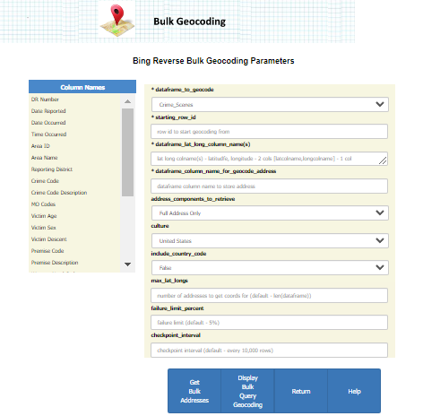
Bulk Geocoding provides the functionality to read a set of addresses or coordinates in a dataframe and process them in bulk mode.
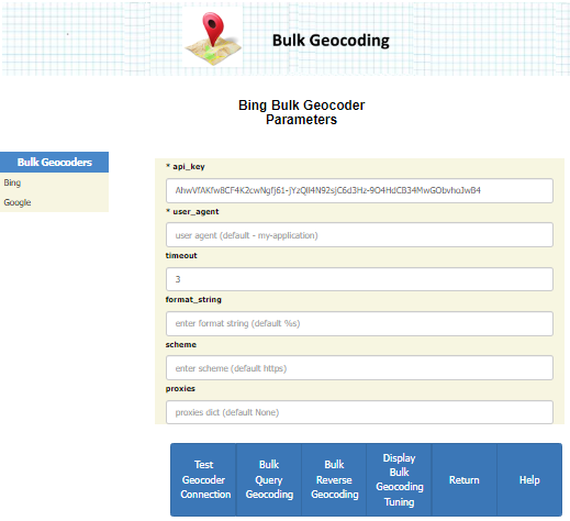
Bulk Geocoding requires that a dataframe is imported and available within dfc.
You will not be allowed to do bulk geocoding withou a valid dfc df is imported.

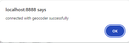
Bulk Geocoding Geocoder Connection Test
Fill in the connecion parms and test the conncetion before continuing.
Bulk Geocoding
Bulk Reverse Geocoding
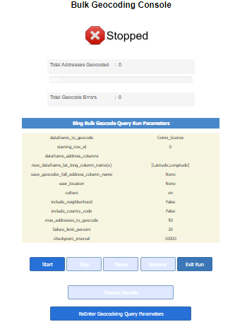
Bulk Geocoding Console
The Bulk Geocoder Console is the console that is displayed to control a bulk geocoding session while it is running.
A Bulk Geocoding session is running as long as it is started and in running or paused mode.
You can use pause and resume to control a session and keep the session intact.
Once a running session is stopped via the user or excessive errors the session is ended and you must start a new session from the beginning again.
Bulk Geocoding Console States
-
-

Running state indicates that dfc geocoding is currently generating geocode results.
-
-

Stopping state indicates that dfc geocoding is no longer submitting new geocode requests and will shut down as soon as possible.
-
-

Stopped state indicates that dfc geocoding is no longer processing any geocode requests and requires new run setup.
-
-

Pausing state indicates that dfc geocoding is no longer processing any geocode requests and will pause when all current geocodes are complete.
-
-

Paused state indicates that dfc geocoding is no longer processing any geocode requests and can be started back where it left via a resume.
-
-

Finished state indicates that current geocoding session is complete and you can process the results.
Bulk Geocoding Progress Bars
-
-
Total Addresses Geocoded
The number of geocode operations completed.
-
-
Total Geocode Errors
The number of geocode errors.
Bulk Geocoding Checkpointing
The checkpoint parm allows you to define when the bulk geocoding is paused and the current retrieved geopints are backed up and can't be lost.
Error Processing
Run Limits
Results Processing
You can start the bulk run via hitting the Start button.
Run Complete
Once the run is comnplete you can process results.
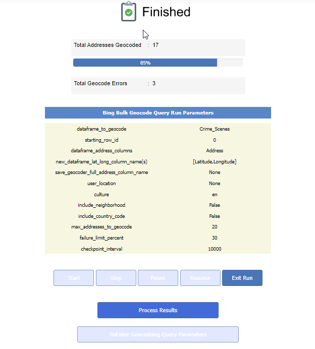
When the run is over you can process results by hitting the Process Results button.
You can finish the run and lose all data by hitting the Exit Bulk Run button.
Process Results
You can now process the bulk run results by hitting the Process Results button.
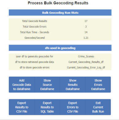
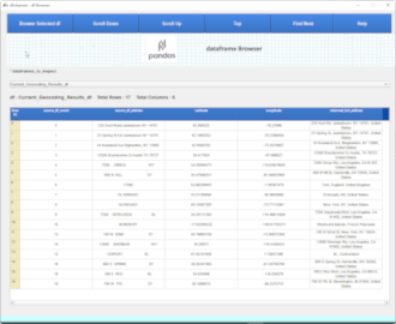
View Geocode Points
You can view the geocode points retrieved by hitting View Results button.
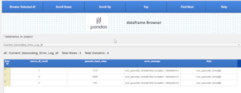
View Geocode Errors
You can view the geocode errors by hitting View Errors button.
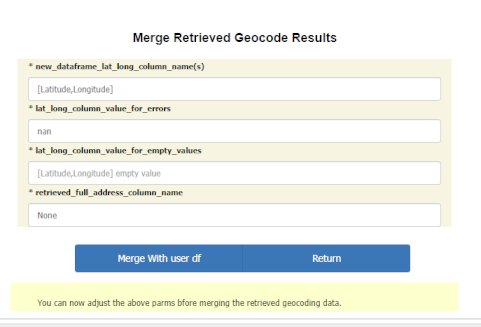
Merge Results
You can then merge the retrieved geocode points into the source df by hitting Merge Results button.
Bulk Geocoding Pricing
Geocode Utilities
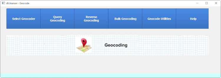
Geocode utilities provides both df column based and interactive functions.
Geocode Distance
Geocode Address Distance
Fill in the connecion parms and test the conncetion before continuing.
The Bulk Geocoder Console is the console that is displayed to control a bulk geocoding session while it is running.
A Bulk Geocoding session is running as long as it is started and in running or paused mode.
You can use pause and resume to control a session and keep the session intact.
Once a running session is stopped via the user or excessive errors the session is ended and you must start a new session from the beginning again.
-
Running state indicates that dfc geocoding is currently generating geocode results.
-
Stopping state indicates that dfc geocoding is no longer submitting new geocode requests and will shut down as soon as possible.
-
Stopped state indicates that dfc geocoding is no longer processing any geocode requests and requires new run setup.
-
Pausing state indicates that dfc geocoding is no longer processing any geocode requests and will pause when all current geocodes are complete.
-
Paused state indicates that dfc geocoding is no longer processing any geocode requests and can be started back where it left via a resume.
-
Finished state indicates that current geocoding session is complete and you can process the results.
-
Total Addresses Geocoded The number of geocode operations completed.
-
Total Geocode Errors The number of geocode errors.
The checkpoint parm allows you to define when the bulk geocoding is paused and the current retrieved geopints are backed up and can't be lost.
You can start the bulk run via hitting the Start button.
Once the run is comnplete you can process results.
When the run is over you can process results by hitting the Process Results button.
You can finish the run and lose all data by hitting the Exit Bulk Run button.
Process Results
You can now process the bulk run results by hitting the Process Results button.
View Geocode Points
You can view the geocode points retrieved by hitting View Results button.
View Geocode Errors
You can view the geocode errors by hitting View Errors button.
Merge Results
You can then merge the retrieved geocode points into the source df by hitting Merge Results button.
Bulk Geocoding Pricing
Geocode Utilities
Geocode utilities provides both df column based and interactive functions.
Geocode Distance
Geocode Address Distance
You can now process the bulk run results by hitting the Process Results button.
You can view the geocode points retrieved by hitting View Results button.
View Geocode Errors
You can view the geocode errors by hitting View Errors button.
Merge Results
You can then merge the retrieved geocode points into the source df by hitting Merge Results button.
Bulk Geocoding Pricing
Geocode Utilities
Geocode utilities provides both df column based and interactive functions.
Geocode Distance
Geocode Address Distance
You can view the geocode errors by hitting View Errors button.
You can then merge the retrieved geocode points into the source df by hitting Merge Results button.
Bulk Geocoding Pricing
Geocode Utilities
Geocode utilities provides both df column based and interactive functions.
Geocode Distance
Geocode Address Distance
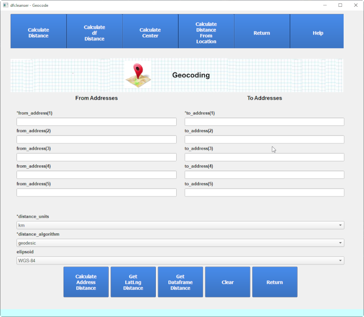
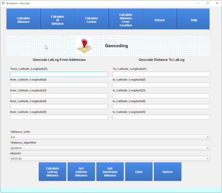
Geocode Lat,Lng Distance
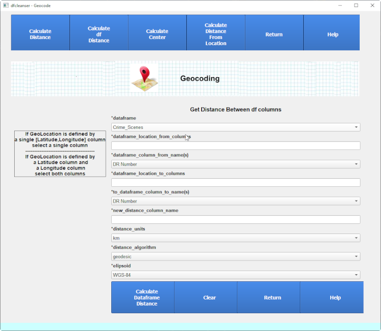
Geocode df Distance
Calculate Distance allows you to calculate the distance(s) interactively or between df columns.
Calculate Distance allows you to calculate distances between geolocation coordinates or addresses.
Calculasting distances between addresses will require the retrieval of geocode coordinates to get distances between.
Calculate Distance Common Parms
Each Distance Calculation requires the user to define the distance algorithm to use.
Parameters:
- distance_units
-
Units of distance to calculate for.
- distance_algorithm
-
Algorithm to calculate distance with.
Please refer to the manual for algorithm definition:
- elipsoid
-
Elipsoid to use to calculate distance with.
Please refer to the manual for elipsoid definition:
Interactive Geocode Distance
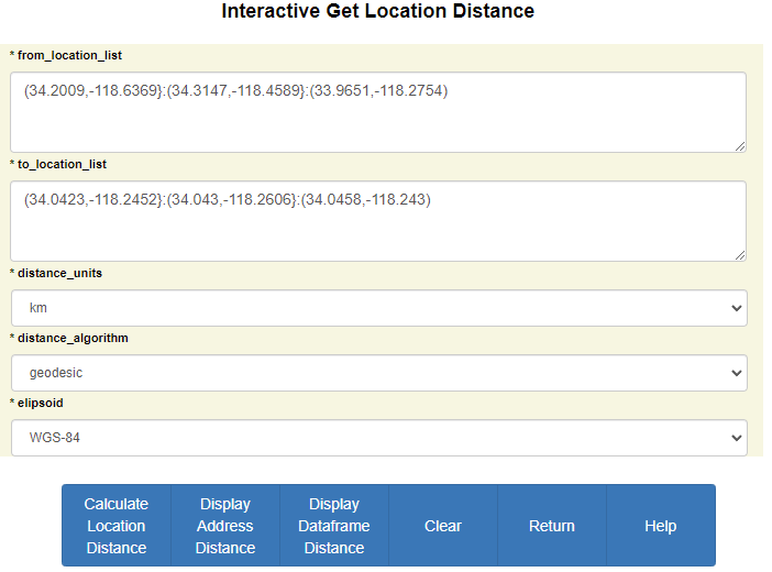
Interactive Distance Between Locations
You can enter sets of geolocation coordinates of Lat,Lng to calculate distances between.
Parameters:
- *from_location_list
-
List of tuples for from locations to get dist between.
- *to_location_list
-
List of tuples for to locations to get dist between.
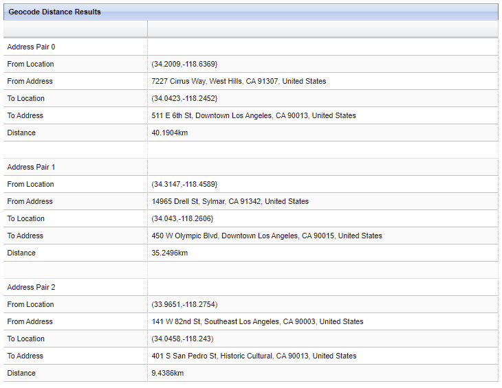
Interactive Distance Between Locations Response
Interactive Distance Between Addresses
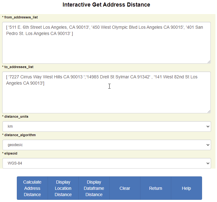
You can enter sets of addresses to calculate distances between.
Parameters:
- *from_addresses_list
-
List of addresses for from locations to get dist between.
- *to_addresses_list
-
List of addresses for to locations to get dist between.
Interactive Distance Between Addresses Response

df Column Distance Calculation
df Column Distance allows you to calculate distances with df columns.
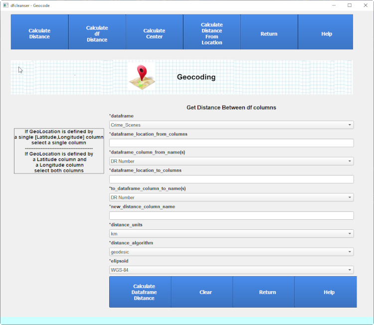
Distance Calculation Between dataframe Columns
You can calculate distance between 2 different df columns. This is only for location columns and not address columns.
if you need to calculate distance address df columns then bulk reverse the address columns.
Parameters:
- *from_dataframe
-
Dataframe for the from geocode location points.
- * from_dataframe_location_columns
-
List of geocode location columns for the from pts.
- * from_dataframe_column_name(s)
-
List of column names to select for the from pts. Can select single or two columns
- *to_dataframe
-
Dataframe for the to geocode location points.
- *to_dataframe_location_columns
-
List of geocode location columns for the to pts.
- *to_dataframe_column_name(s)
-
List of column names to select for the to pts. Can select single or two columns
- *new_distance_column_name
-
Column name to store the distance results in. Column added to from dataframe.
Distance Calculation Between dataframe Columns Response

Distance Calculation Between dataframe Column and Nearest Location
You can calculate the nearest distance between df column and user set of locations.
The distance is calculated between the df column and each of the user locations and store the nearest location.
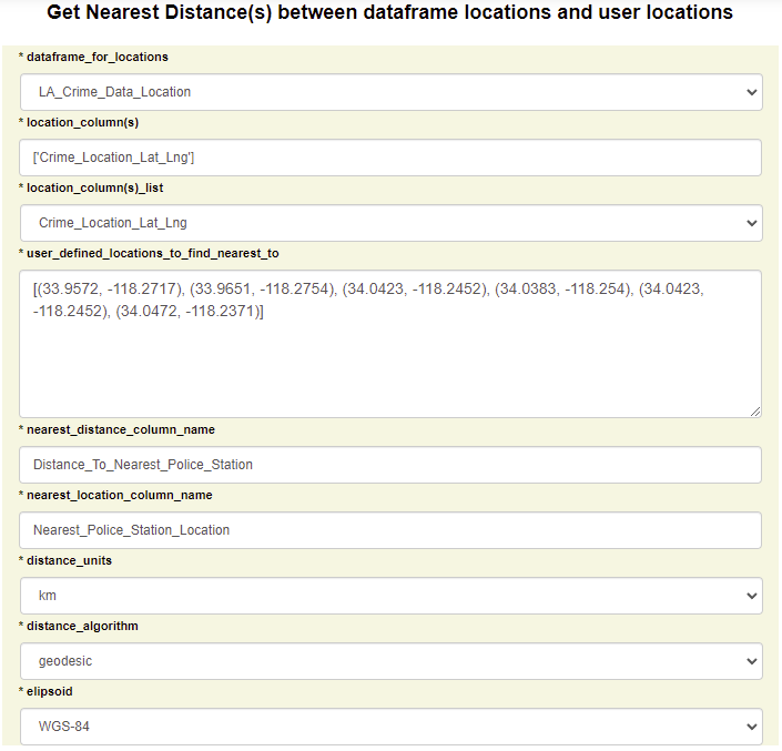

Parameters:
- * dataframe_for_locations
-
Dataframe for the geocode location points.
- *location_columns
-
List of geocode location columns for the pts.
- *location_column(s)_list
-
List of column names to select for the pts. Can select single or two columns
- *user_defined_locations_to_find_nearest_to
-
User defined lisr of locations to find nearest to.
- *nearest_distance_column_name
-
Column name to store nearest distance in.
- *nearest_location_column_name
-
Column name to store the nearest location in.
Distance Calculation Between dataframe Column and Nearest Location Response

Distance Calculation Between dataframe Column and Center Location
You can calculate thedistance between df column and a center point locations.
The center point location can be calculated as the center point of the df location column or as a user defined center point.
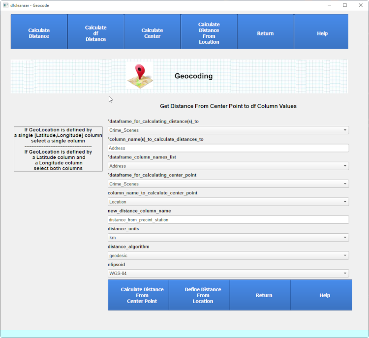
Parameters:
- *location_dataframe
-
Dataframe for the geocode location points.
- *location_dataframe_column(s)
-
List of geocode location columns for the pts.
- *location_dataframe_column(s)_list
-
List of column names to select for the pts. Can select single or two columns
- * center_point_opton
-
User selected center point type.
- * user_defined_center_point
-
Center point defined by the user.
- * dist_to_center_column_name
-
Column name to store the distance in.
Distance Calculation Between dataframe Column and Center Point Response

Calculate Center
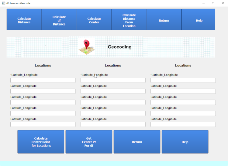
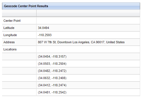
Calculate Center allows you to calculate the center from a set of user defined coords or addresses.
Calculate Center From Locations
Calculate Center From Locations Input
Calculate Center From Locations Response
Calculate Center From Addresses
Calculate Center From Addresses Input
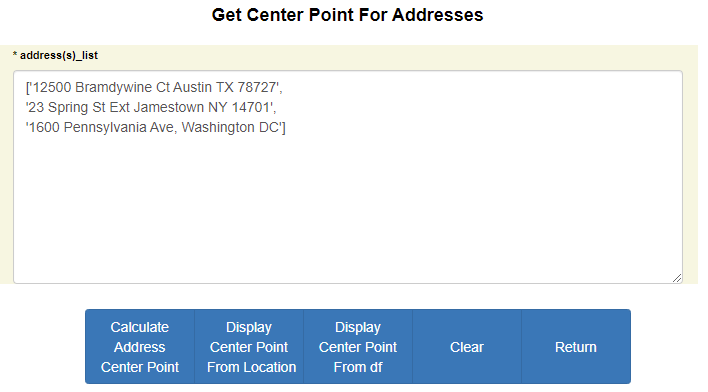
Calculate Center From Addresses Response
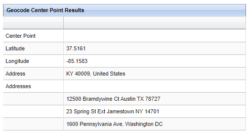
Calculate df Column Center
Calculate df Center allows you to calculate the center from a df column.
Calculate df Column Center Input
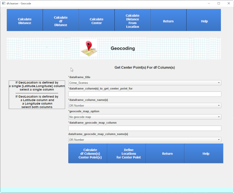
Calculate df Center Response
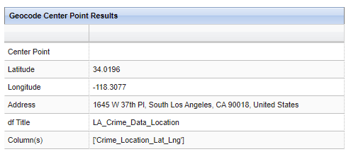
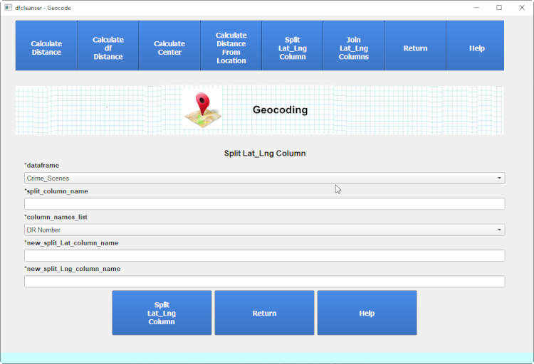
Split LatLng Column
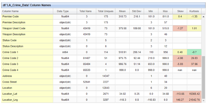
Split LatLng Column allows you to split string representation of a lat,lng pair into separate Lat and Lng columns.
Split LatLng Column Inputs
Split LatLng Column Response

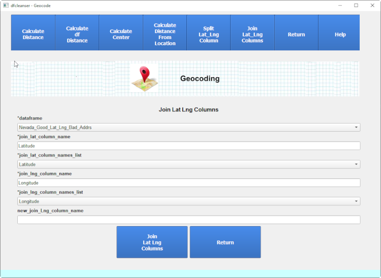
Join Lat Lng Columns
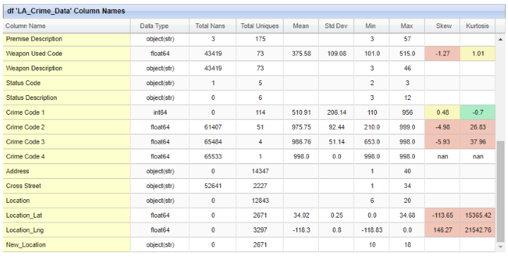
Join Lat Lng Columns allows you to join lat and long float columns to a single string representation.
Join Lat Lng Columns Inputs
Join Lat Lng Columns Response

Calculate Distance allows you to calculate the distance(s) interactively or between df columns.
Calculate Distance allows you to calculate distances between geolocation coordinates or addresses.
Calculasting distances between addresses will require the retrieval of geocode coordinates to get distances between.
Calculate Distance Common Parms
Each Distance Calculation requires the user to define the distance algorithm to use.
| Parameters: |
|
|---|
Interactive Geocode Distance
Interactive Distance Between Locations
You can enter sets of geolocation coordinates of Lat,Lng to calculate distances between.
| Parameters: |
|
|---|
Interactive Distance Between Locations Response
Interactive Distance Between Addresses
You can enter sets of addresses to calculate distances between.
| Parameters: |
|
|---|
Interactive Distance Between Addresses Response
df Column Distance Calculation
df Column Distance allows you to calculate distances with df columns.
Distance Calculation Between dataframe Columns
You can calculate distance between 2 different df columns. This is only for location columns and not address columns.
if you need to calculate distance address df columns then bulk reverse the address columns.
| Parameters: |
|
|---|
Distance Calculation Between dataframe Columns Response
Distance Calculation Between dataframe Column and Nearest Location
You can calculate the nearest distance between df column and user set of locations.
The distance is calculated between the df column and each of the user locations and store the nearest location.
| Parameters: |
|
|---|
Distance Calculation Between dataframe Column and Nearest Location Response
Distance Calculation Between dataframe Column and Center Location
You can calculate thedistance between df column and a center point locations.
The center point location can be calculated as the center point of the df location column or as a user defined center point.
| Parameters: |
|
|---|
Distance Calculation Between dataframe Column and Center Point Response
Calculate Center
Calculate Center allows you to calculate the center from a set of user defined coords or addresses.
Calculate Center From Locations
Calculate Center From Locations Input
Calculate Center From Locations Response
Calculate Center From Addresses
Calculate Center From Addresses Input
Calculate Center From Addresses Response
Calculate df Column Center
Calculate df Center allows you to calculate the center from a df column.
Calculate df Column Center Input
Calculate df Center Response
Split LatLng Column
Split LatLng Column allows you to split string representation of a lat,lng pair into separate Lat and Lng columns.
Split LatLng Column Inputs
Split LatLng Column Response
Join Lat Lng Columns
Join Lat Lng Columns allows you to join lat and long float columns to a single string representation.
Join Lat Lng Columns Inputs
Join Lat Lng Columns Response